 Watch Video
Main Challenges When Navigating
![]()
Disorientation
Ascending the metro is typical example
![]()
Confusion
Translating 2D to 3D can be harder than it seems
![]()
Inaccurate GPS
Buildings can heavily interfere with the signal


Out-of-View
The OoV-indicators combined with AR technology enables us to extend the screen into the real world. We keep track of AR objects without being limited to the small window of the screen
Landmarks
Historically man has navigated with the help of reference points. The north star, a mountain top or a church tower has been the means of maintaining orientation. In the evergrowing concrete jungle this has become more difficult as buildings grow taller and the distance of our view becomes limited. We are happy to once again enable this means of orientation through AR, constantly making sure the user has a city landmark available for reference
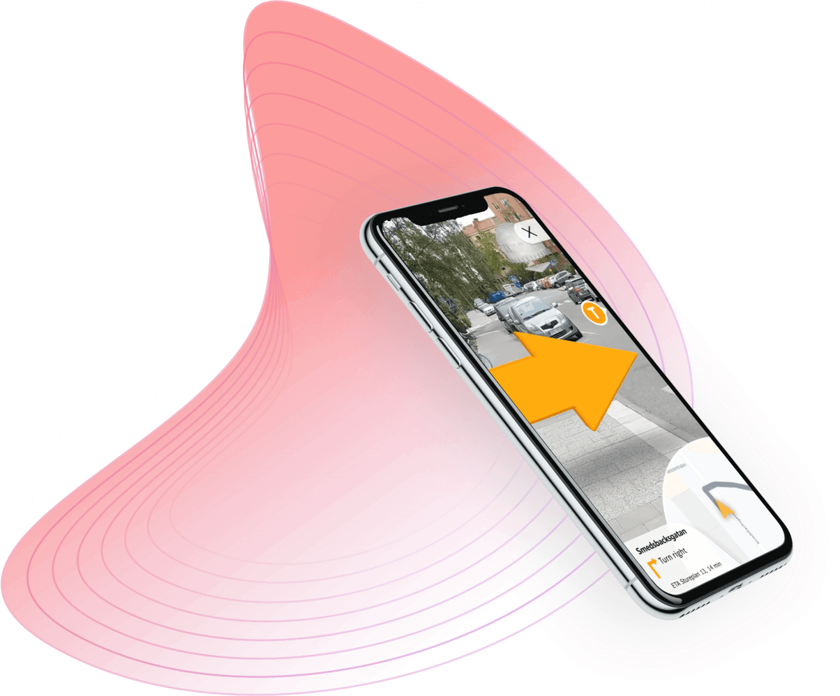
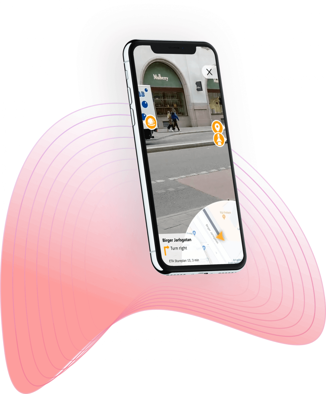
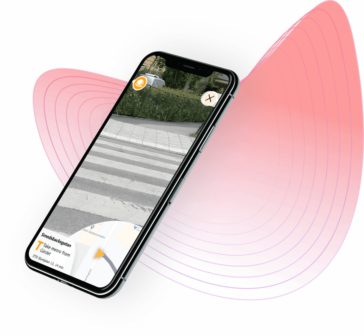
World Space Directions
No more “lost in translation” between the 2D map and navigating the real world. We bring the directions into world space and place AR directional arrows, guiding the user every step of the way to the destination
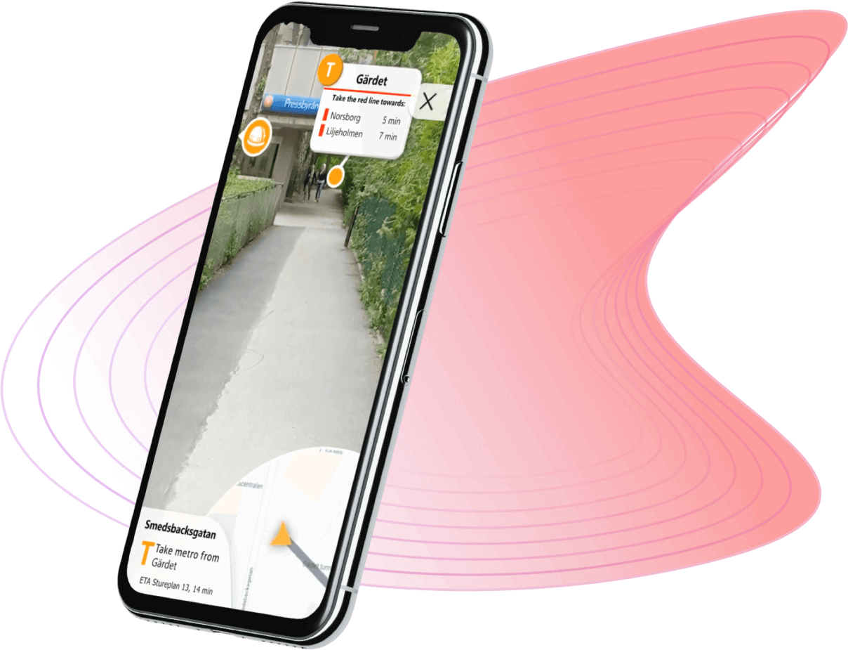
Points-of-Interest
Keeping the user updated with the latest live information regarding departures and transits, attached to every station of interest

By combining traditional GPS data with new technologies using spatial anchors, we are able to pinpoint locations with centimetre precision. The spatial anchors utilize the camera feed to create virtual anchors from the data points it identifies. The anchors enable persistent tracking in spaces with limited or no gps signal, making it possible to navigate indoors as well. An ideal functionality for maneuvering large train stations and finding correct connections.
Our state-of-art Mobile AR technology runs on all modern iOS and Android devices.